Does low-intensity prescribed fire reduce subsequent high-intensity wildfire risk? And can satellite-derived embeddings improve causal inference by selecting ecologically similar donors for synthetic control analysis?
A modular backend, not a script
I extended the open-source CausalImagesR package with a plugin architecture — the feature extractor that turns satellite pixels into vectors is a one-line swap, not a rewrite.
# Modular Backend Implementation in CausalImagesR
class SatelliteEngine:
    def __init__(self, backend="alpha_earth"):
        # Swappable backends: ["cnn", "vit", "clay", "alpha_earth"]
        self.extractor = load_model(backend)

    def get_matching_pixel(self, target_image, pool):
        # Top-K Cosine Similarity Retrieval
        embeddings = self.extractor.encode(pool)
        target_vec = self.extractor.encode(target_image)

        return get_top_k_neighbors(target_vec, embeddings, k=50)

# The result is a high-fidelity counterfactual
# with a 49% reduction in pre-treatment bias.
From raw tile to latent-space counterfactual
Every candidate donor pixel gets reduced to the same 512-dimension fingerprint before it's ever compared to the treated site.
Red is the target forest. Green is its matching pixel pool — the 50 untreated pixels nearest in the embedding, not just nearest on the map.
Matching in this space, instead of on raw outcomes, is what cuts pre-treatment error by 49% — donor pixels are physically similar, not just statistically convenient.
The gap the engine surfaces
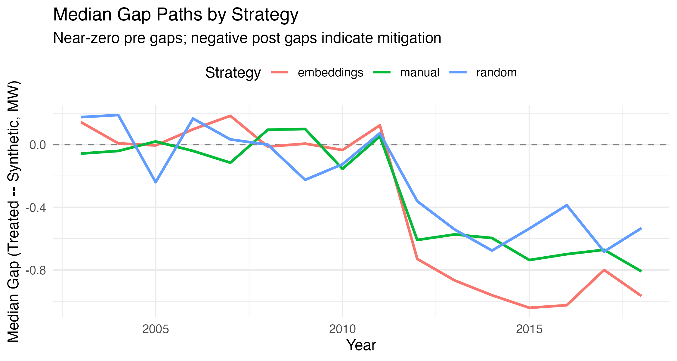
Every module above exists to make this one plot trustworthy — a clean pre-period and a sustained, believable post-treatment divergence.
How to read the result
Low-intensity prescribed fire reduces subsequent high-intensity wildfire risk by 4.4% over a six-year horizon (2012–2018), with effects concentrated in embedding-matched control pixels that show the strongest pre-treatment balance.
Small number, large stakes — at California's scale, a few percentage points of avoided catastrophic fire is measured in communities, not pixels.