Alternate Wetting & Drying saves water in the Mekong. Does that success transfer to Japan, and where?
The deliverable
A web app for farmers and policy makers at the Japan Rice Institute that identifies exactly where, when, and under what conditions AWD can be safely scaled across Japan — maximising carbon credit verification while protecting farmer livelihoods.
Pick any location in Japan and it returns a Suitability Class with the reasons behind it, synthesised from eight datasets of location-specific biophysical conditions: 20+ years of average seasonal precipitation, temperature and evapotranspiration, plus high-resolution slope, soil texture, pH, moisture and drainage metrics.
Two countries, one water balance
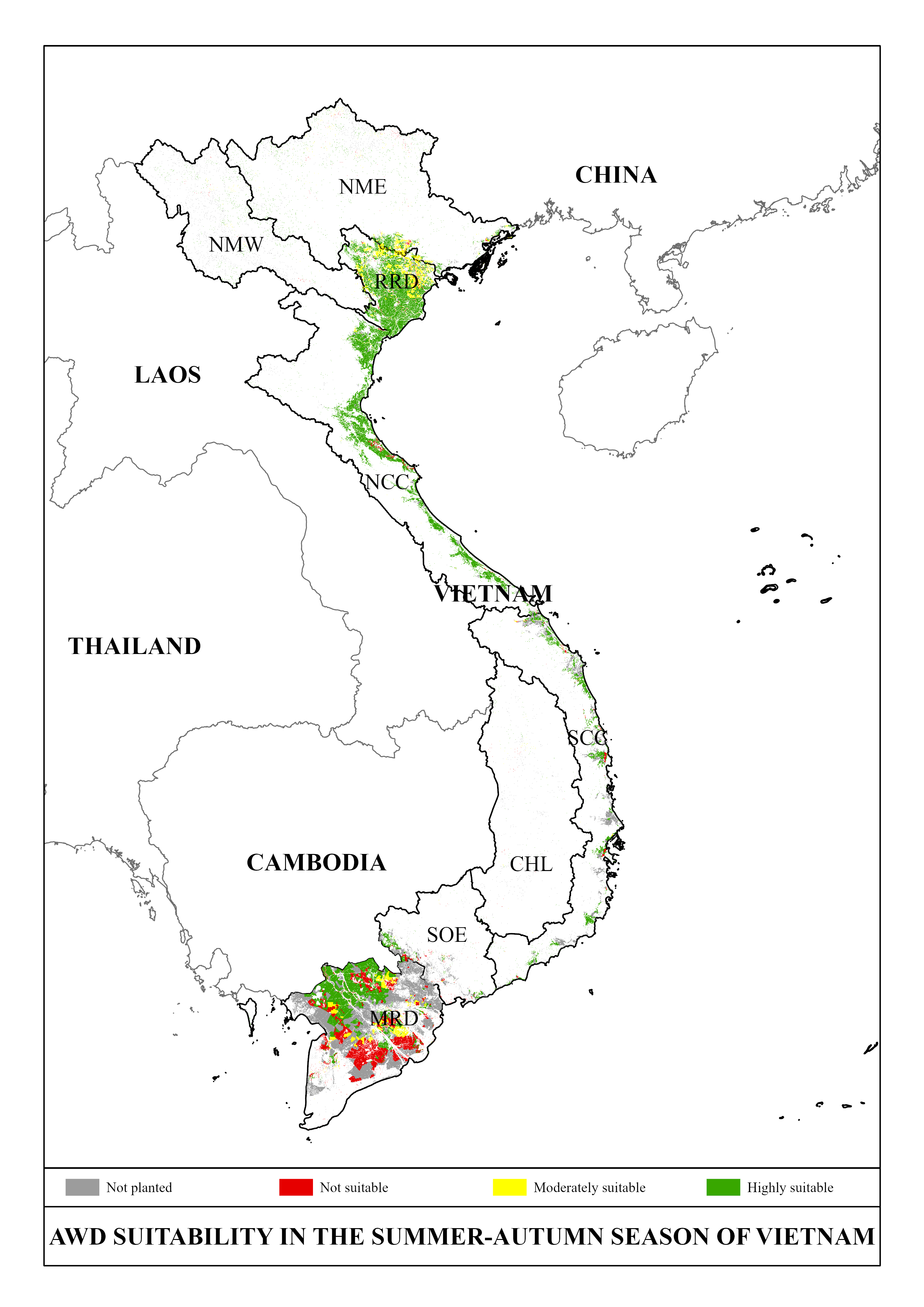
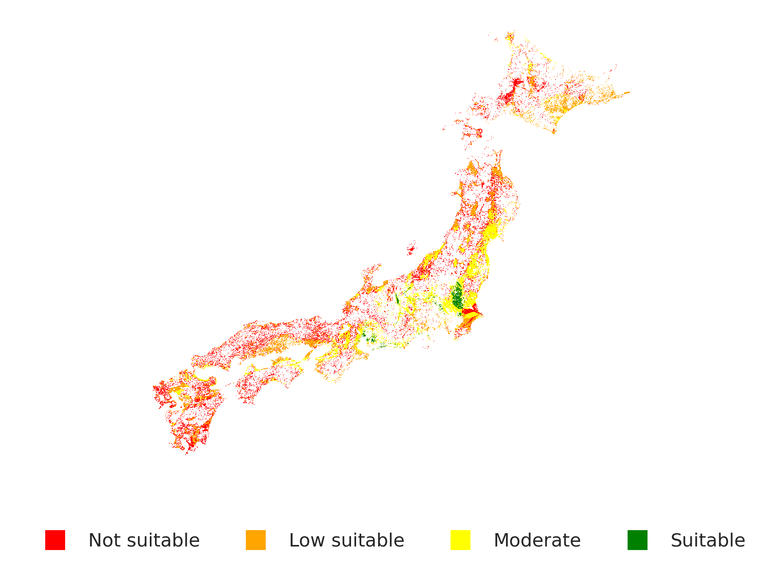
A water-balance suitability model over hydrological index and topographic slope, run on both landscapes. Where Vietnam is broad and flat, Japan is steep and fragmented — and the map tells the story.
The honest number matters
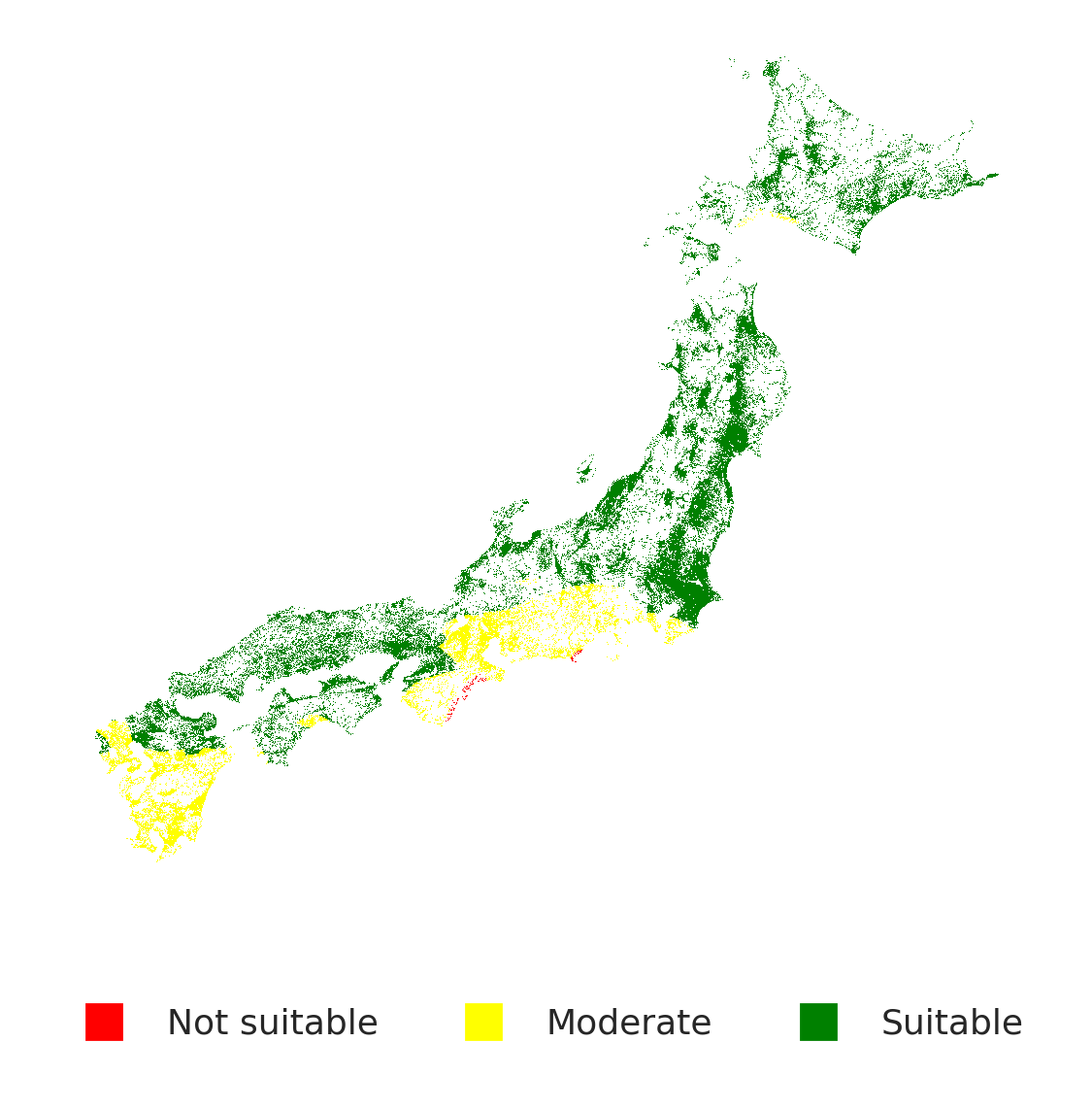
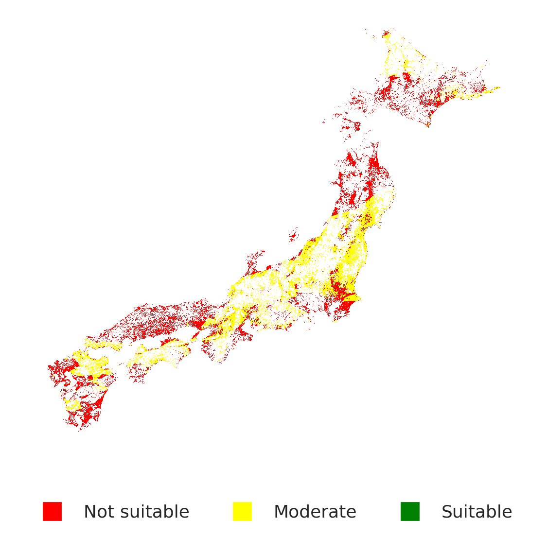
A naïve transfer would greenlight AWD across 62% of Japan. However, after correcting for bias in the water balance model and accounting for topographic slope and field moisture, only 18% remains truly feasible — an overestimation of 3.4×. Knowing where NOT to deploy is as valuable as knowing where to.
Why the naïve model overestimated by 3.4×
Water deficit alone doesn't make a paddy AWD-suitable. How you count that deficit does — and the standard model counts it the wrong way.
Every deficit counted the same
The water balance for each dekad (10-day period) is WB = P − (PET + Percolation) — rainfall minus evapotranspiration and soil percolation. The standard model just flags WB < 0 as "a suitable drying dekad," whether the shortfall is −5 mm or −150 mm.
That's the bug: a −150 mm dekad doesn't mean gentler drying, it means the field has blown past the soil-moisture threshold into crop stress — the opposite of AWD-suitable. Counting it as a win is what inflates the map to 62% of Japan.
A threshold, not a coin flip
We rebuilt the dekad-level water balance in Earth Engine — CHIRPS daily rainfall summed to dekads, MODIS MOD16A2 evapotranspiration reprojected to the 500m study grid, percolation from SoilGrids texture class — then reclassified deficit against a −50mm safe-drying ceiling instead of a bare zero.
A dekad only counts as suitable if the deficit occurs and stays inside that ceiling. Re-run at that threshold, the map drops from 62% to a defensible 32% before biophysical constraints are even applied.
How strict should "safe" be?
Drag to change the maximum allowable water deficit per dekad. Looser thresholds count more area as suitable — but risk pushing paddies past safe drying.